
| Location: | St. Augustine, FL |
|---|---|
| Excavator(s): | Olga Caballero; John Clauser; Kathleen Deagan; Charles Ewen; Frederick Gaske; Julia Kind; Bonnie McEwan; Carl McMurray; Charles Poe; Robert Steinbach |
| Dates excavated: | 1963 (Steinbach); 1972 (McMurray); 1973, 1976 (Deagan); 1975 (Clauser); 1979 (Caballero); 1980 (King and Gaske); 1981 (Gaske and Poe); 1982-1983 (Poe and Ewen); 1985 (McEwan) |
Overview
The Ximénez-Fatio site (SA 34-2) is located at 20 Aviles Street (Block 34, Lot 2) in St. Augustine, Florida. The house is named after Andres Ximénez, who acquired the property in 1797, and Louisa Fatio, who purchased the property in 1855. However, the site’s domestic history extends to the late sixteenth-century (Deagan 1985), making it one of the oldest house lots in St. Augustine.
Most of the site’s documented history prior to the eighteenth-century has been revealed through archaeological studies (Deagan 1985; King 1984; Reitz 1985, 1992; Scarry 1985). Today the site is distinguished by its three-story coquina home built by Ximénez in 1797. Waterbury (1985: 1) describes the Ximénez-Fatio house and property as the “successor of an unknown number of structures” due to subsequent modifications over the course of the nineteenth-century. For example, in 1830 the property transitioned to a boarding house under Margaret Cook’s ownership. Successive owners Sarah Anderson (1838-1855) and Louisa Fatio (1855-1875) continued operating the home and property as a boarding house. This forty-five-year boarding house history, often referred to as the Boarding House/Hotel Inn Period component of the site, attracted many guests looking to escape the harsh winters of the northern states.
In 1937, the Carnegie Restoration Committee recognized the architectural significance of the Ximénez-Fatio house (NRHP 1973). Two years later, the Florida Chapter of the National Society of the Colonial Dames of America purchased the property from David Dunham, the nephew of Louisa Fatio. Restoration efforts under the Colonial Dames of America brought a new phase to the property, including successive archaeological projects between 1965 and 1985 and a successful nomination to the National Register of Historic Places in 1973. Interest in the site’s architectural evolution fostered several archaeological field schools through the University of Florida and Florida State University. The first excavation of the site was conducted by Robert Steinbach of the Historic St. Augustine Preservation Board in 1963. Charles Fairbanks followed up on Steinbach’s work as the principal investigator of excavations supervised by Carl McMurray (1972), Kathleen Deagan (1973), and John Clauser (1975). From 1976 to 1985, Kathleen Deagan took on the role of the principal investigator for projects conducted by Olga Caballero (1979), Julia King (1980), Frederick Gaske (1980, 1981), Charles Poe (1981, 1982), Charles Ewen (1983), and Bonnie McEwan (1985). Archaeological field records of these projects are currently housed and curated at the Florida Museum of Natural History under the Historical Archaeology program.
Documentary Evidence
The earliest documented owner of the Ximénez-Fatio property was Christoval Contreras. Born on the island of Tenerife in the Canary Islands, Contreras worked as a merchant in St. Augustine during the eighteenth-century Spanish I Period. Deagan (2007: 109) maintains that Contreras occupied the lot during the last five years (1758-1763) of the Spanish I Period after marrying the local criolla, Dortea de Anaya, in 1758. Their lot measured 26 varas (71.5 ft) by 46 varas (126.5 ft) and was bounded on the north by the property of Doña Manuella Alvarez de Santiago (Ellrich 2023: 141). Contreras is described as a successful merchant who owned at least one slave (Deagan 2007; Reitz 1992: 85). He and his wife had a son, Luis, and the family relocated to Cuba when the British took control of Florida in 1763.
The property had several owners throughout the British Period (1763-1783). The first owner, Gerald Walton, worked as a merchant in New York, and a 1765 account indicates that the property included a “stone house and out houses” (Snodgrass 1972). That same year, Dr. Richard Pritchard received a grant and a deed from Walton to build a home on the property. Pritchard subsequently sold the property to William Wilson in 1772, and between 1772 and 1776 the lot consisted of two masonry structures and a wooden one (Ellrich 2023: 141). During Wilson’s ownership, a portion of the lot was leased to William Dry for a year. At the conclusion of their lease agreement in 1772, Wilson sold two portions of the property to Dry. While it is unclear if Dry lived on the property, since he owned another lot in town, records indicate that he retained ownership of the property until the end of the British Period in 1783.
With the return of Spanish rule in 1783, the property reverted to the Spanish crown. The de la Rocque map of 1788 describes the property as “the ruins of a masonry house in bad condition” owned by Luis Contreras, the son of Christoval Contreras (Shephard 1973). In 1790, records show that Francisco de la Rocha, a local tailor, held ownership. De la Rocha may have worked as an agent for Contreras, and in 1791 the lot was sold at public auction to Juan Hernandez who later sold it to Andres Ximénez in 1797. Purportedly, no improvements had been made to the property during Hernandez’s ownership and, according to King (1981: 47), it was devoid of any standing structures when Ximénez purchased it.
A peninsular from Ronda, Spain, Ximénez worked as a local merchant. His wife, Juana, was the daughter of the prominent Minorcan carpenter and businessman, Francisco Pellicer. Together, the Ximénez’s had five children. The lot received extensive developments under Ximénez’s ownership. One was the building of a two-story, wing plan coquina house that included, on the first floor, a grocery store and billiards room. Other property developments included an outdoor kitchen, two outhouses, a woodshed, and a wooden privy (Newton 1964). Ximénez’s wife passed sometime before 1802, and his three surviving children inherited the property following his death in 1806. Between 1806 and 1830, it is unclear who lived on the property. Margaret Cook, a merchant from Charleston, South Carolina, acquired the property and grocery store from the Ximénez heirs in 1830 (Waterbury 1985). During Cook’s ownership, the home was turned into a boarding house.
For additional accounts based on primary sources, see Harman (1970) and Waterbury (1985).
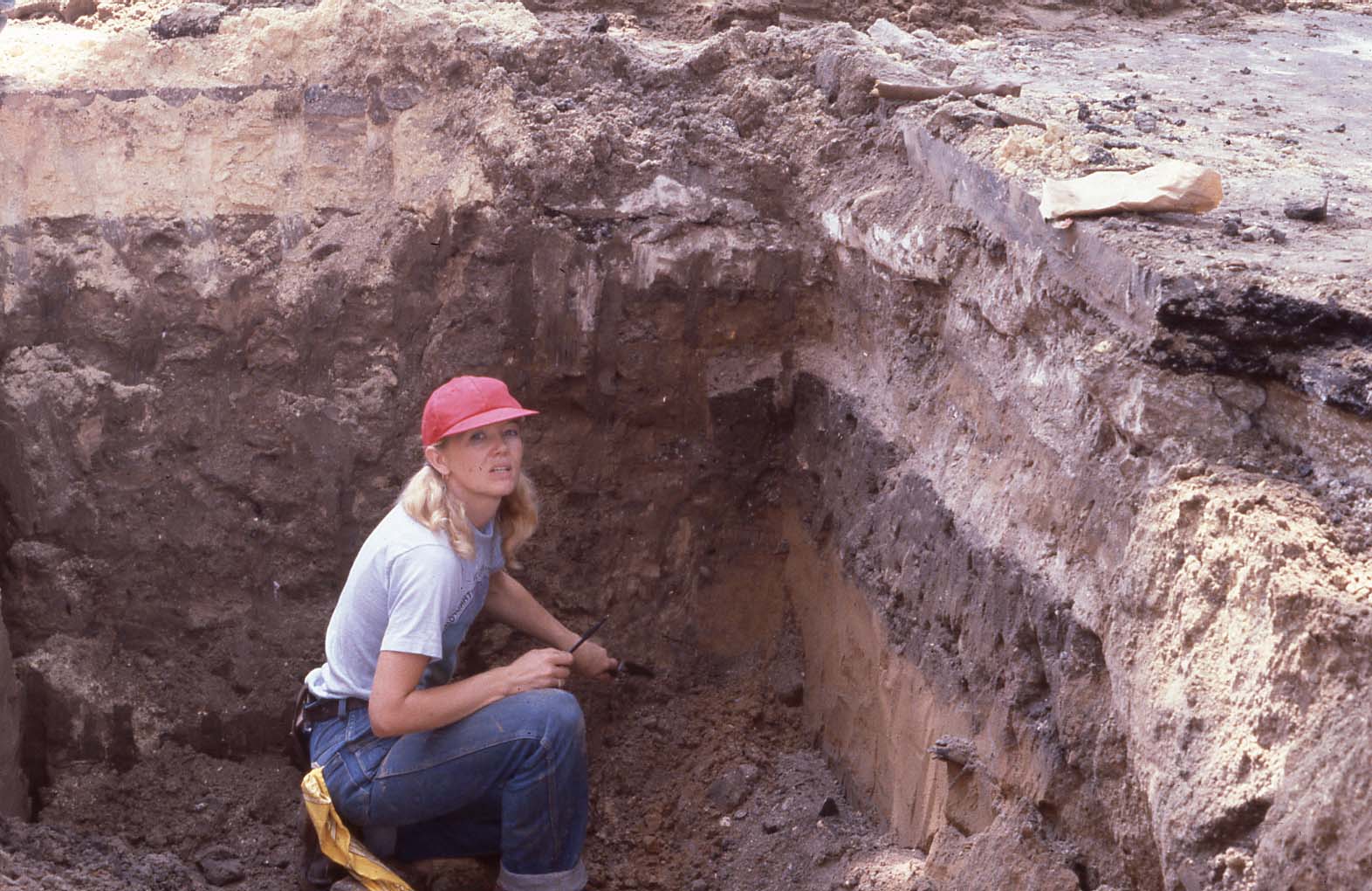
Excavation History, Procedures, and Methods
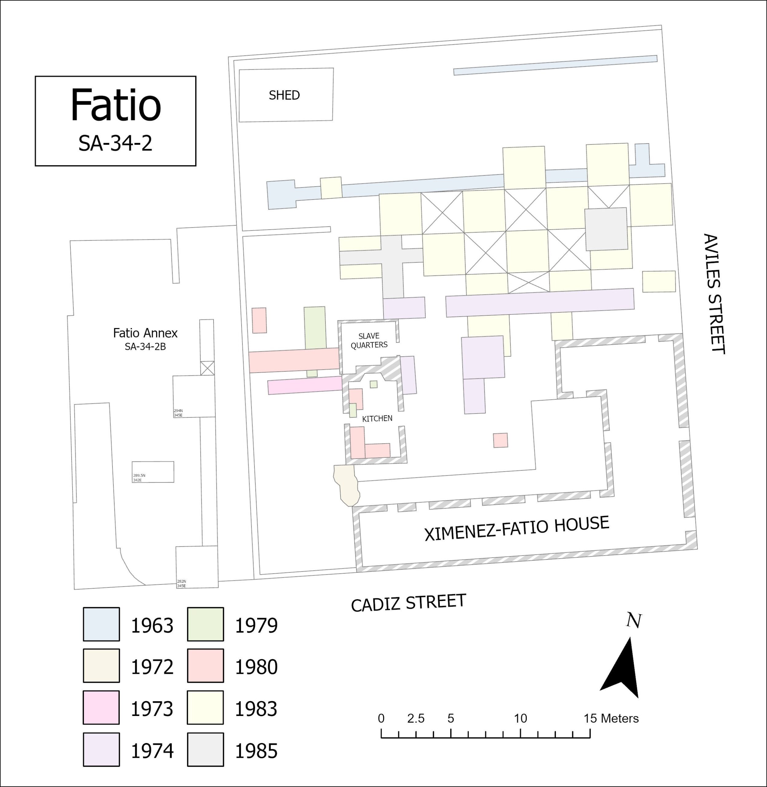
Robert Steinbach carried out the first archaeological research on the Ximénez-Fatio site in 1963. Two trenches, labeled A and B, were excavated in the northern portion of the lot, and the purpose of the investigation was to determine if structures included on the 1764 de la Puente map and 1788 de la Rocque map could be identified archaeologically. Trench A was 95 feet long and 3 feet wide, except at the west end where the remnants of a tabby floor were encountered. Trench B was 64 feet long and 1.5 feet wide. Artifacts recovered were “primarily British in origin” and consisted “almost entirely of ceramics” (Steinback 1963: 2). The tabby foundation encountered in Trench A was perhaps related to a small eighteenth-century Spanish I Period outbuilding.
Between 1972 and 1974, Charles Fairbanks directed further excavations. The 1972 excavation took place in an area identified as the “Old Slave Kitchen” on the southwest side of the property. Carl McMurray conducted the excavation, and similar to Steinbach’s interest in archaeologically testing historic St. Augustine maps, the objective of the investigation was to see if the extant kitchen building on the lot was the same one shown on the 1764 de la Puente map, or else built on the foundation of the one depicted on the 1764 map (Deagan 1973; McMurray 1972). A 3.5 x 11 foot trench was excavated and screened using 1/2 inch hardware cloth. Unit levels, divided into five zones, were established based on stratigraphy and artifact composition. An additional 2 x 2 foot test pit was excavated at the far north, against the south wall of the kitchen building. No evidence was found to support the hypothesis that the kitchen building was associated with the structure depicted on the 1764 de la Puente map (McMurray 1972).
Kathleen Deagan conducted the 1973 excavation under Fairbanks direction. The primary goals of the investigation were to confirm McMurray’s conclusions and to seek evidence of an earlier structure (Deagan 1973). A 1.5 x 4.5 meter trench was excavated along the west side of the kitchen building. Vertical control was maintained using a transit, and soil, excavated in 15 cm levels, was screened using 1/4 inch hardware cloth. To obtain profiles of the extant kitchen building, an additional 1.5 x 2.0 meter test unit was excavated in the southeast corner of the trench. McMurray’s 1972 conclusions were upheld. However, Deagan exposed an ormigón floor believed to be associated with one the warehouses mentioned in Ximénez’s 1806 will.
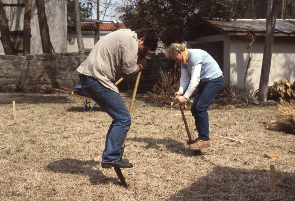
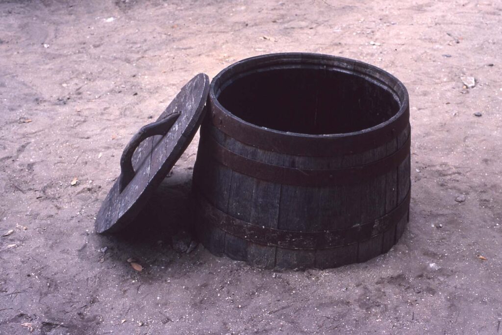
In 1974, John Clauser conducted excavations as part of a University of Florida field school. Herschel Shephard, a restoration architect, participated in the project. One of the goals of the excavation was locating and documenting structural remains to compare against historic maps. Another goal was recovering cultural material to compare against other St. Augustine house lots (SA 7-5, SA 7-6, and SA 16-23) that had been excavated on the northside of town (Clauser 1975: 6, 36). All units, except one, were excavated on a grid system, and unit coordinates were based off of the southwest corner. Excavated soil, originally screened using 1/4 inch hardware cloth, was replaced by 3/8 x 3/4 inch diamond mesh after a “general idea of the size of and type of artifacts on the site was obtained” (Clauser 1975: 20). One structure, interpreted as the remains of one depicted on the de Solis (1764) and Moncrief (1765) maps, was documented. Clauser also recorded a tabby foundation, a barrel well, 20 refuse pits, and an H-shaped fireplace believed to have been built during the British Period and later incorporated into the design of Ximénez’s home. Field maps and notes for the 1974 investigations have been lost (King and Zierden 1980).
In 1976, Deagan directed a systematic auger survey of downtown St. Augustine in an effort to determine the limits of the original sixteenth-century Spanish settlement. The Ximénez-Fatio property was included in the survey and falls within the town’s initial occupation (Deagan 1981).
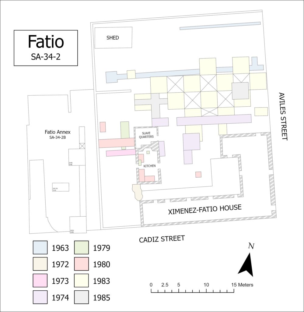
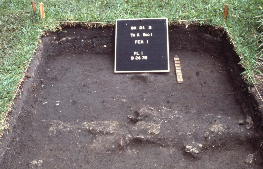
Funds from the Colonial Dames of America supported additional excavations between 1979 and 1985 with Deagan as the principal investigator. The 1979 excavation, conducted by Olga Caballero, focused on the property’s early-to-late-nineteenth-century Hotel Inn Period. A total of three units were excavated. Trench A (1.5 x 6.5 meter) was placed along the kitchen’s exterior west wall. Test Pit 1 (0.5 x 0.5 meter), located inside the kitchen, encompassed part of the building’s hearth along the north wall. Test Pit 2 (0.5 x 1 m) was also placed inside the kitchen along the west wall and included the north half of the west door. Unit coordinates were based off of the southwest corner, and all excavated material was watered screened using 1/4 inch hardware cloth. The results of Trench A included evidence of a wooden structure, extending from the north wall of the kitchen towards the east. Caballero (1979) interpreted this structure to have been built no earlier than 1820. The kitchen’s interior excavations indicated at least three construction stages: 1) post-1780 (perhaps by Ximénez), 2) post-1830, and 3) a modern concrete cap removed prior to the excavation.
Further work at the kitchen building took place in the spring and summer of 1980. Supervised by Julia King and Frederick Gaske, the 1980 excavations, which served as part of a Florida State University field school, sought to contribute additional information on the lot’s architectural evolution. King and Gaske reestablished Clauser’s 1974 site grid, and Caballero’s 1979 cataloging system and field protocols were extended to their field project. A single test trench (1.5 x 5.38 meters), designated Trench D, was placed along the exterior northwest kitchen wall. Vertical control was maintained using a datum plane tied to a manhole cover located on Aviles Street, and building material less than 1 cm in diameter was discarded. During the summer fieldwork, 4 features, 31 areas (defined as amorphous soil discoloration or an intrusion into the soil matrix), 12 postmolds, and 1 possible postmold were recorded (King 1980).
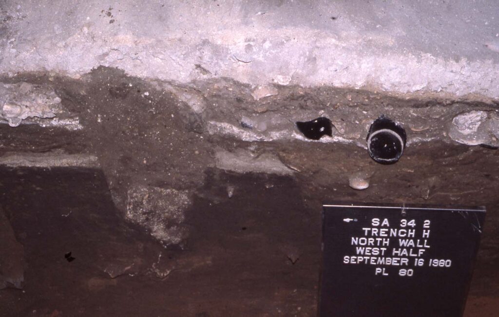
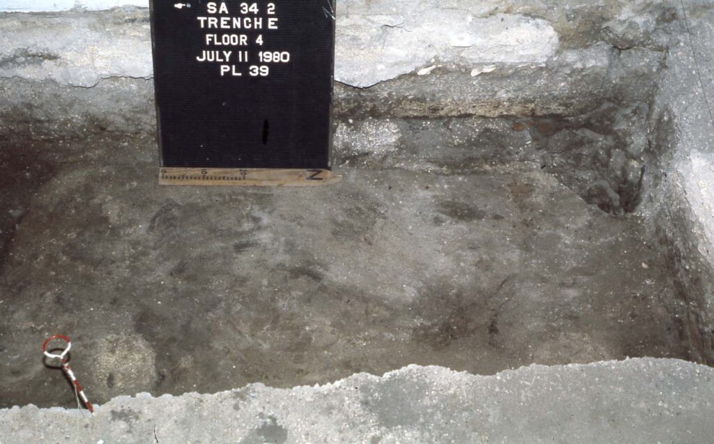
Field protocols established in the spring season were maintained during the 1980 summer fieldwork. Trench D received a 1.3 meter extension, and a 0.75 x 1.5 meter test pit was placed in the kitchen’s garden area. Inside the kitchen building, four additional test trenches were excavated, labeled E through H. To maintain vertical control in the kitchen building, an arbitrary datum was tied to the manhole cover located on Aviles Street. Trenches E (1.0 x 2.27 meter) and F (1.0 x 1.5 meter) were placed along the west wall, bisecting Caballero’s 1979 Test Pit 2. Trench G (0.86 x 2.1 meter) was opened in the kitchen’s north room in an attempt to uncover evidence of a nineteenth-century wash house that had been documented in the exterior excavations. Trench H (1.0 x 1.8 meter) abutted Trench E along the kitchen’s south wall.
In February 1981, Frederick Gaske and Charles Poe conducted a nine-day monitoring project. The project involved lowering the courtyard/patio area between the house and kitchen to the site’s Hotel Inn Period grade level (Gaske 1981: 1). Field protocols established in 1980 were maintained, and a 1 x 1 meter test pit was excavated in the southeast corner of the project area to document the stratigraphy. The project exposed a lens of crushed coquina believed to be associated with the Hotel Inn Period. Additionally, 25 postmolds, 1 posthole, 15 areas, 7 pits, and several modern intrusions such as pipe trenches and three units from Clauser’s 1974 excavations were recorded.
Charles Poe and Charles Ewen supervised further excavations in 1982 and 1983. Two objectives guided their efforts. The first was to locate gardens, pathways, fences, and outbuildings associated with the Hotel Inn Period component of the site to inform ongoing reconstruction efforts on the property. The second was to record documented and undocumented occupations on the site to aid in the overall interpretation of colonial St. Augustine (Ewen 1984: 1). Field protocols set in prior field seasons were maintained, and the original site grid was reestablished. The first half of the project involved a crew of three trained archaeologists under the supervision of Poe while the second half, supervised by Ewen, was completed by a University of Florida field school. A total of 15 units were excavated in 5-centimeter levels (Ewen 1985), and an 1834 map and a 1930 Sanborn map helped guide the placement of units. Most of the units measured 3.0 x 3.0 meter (n=11) with the remaining three measuring 1.5 x 2.12 (n=1) and 1.5 x 1.5 meters (n=2). An auger survey, spaced on a 2-meter interval grid, was also performed, and floral and faunal samples were analyzed by Margaret Scarry (1984) and Elizabeth Reitz (1983). The 1982 and 1983 excavations confirmed many of the conclusions drawn from previous excavations (Ewen 1985: 65). No walkways, gardens, or outbuildings were discovered. However, a possible fence line thought to be associated with Hotel Inn Period was recorded along with a possible late sixteenth-century wattle and daub structure.
In 1985, Bonnie McEwan conducted additional excavations under the direction of Deagan. The results of the 1982 and 1983 excavations guided the investigation, which comprised of two goals. The first goal was to reexamine the series of postmolds believed to be associated with the possible fence line documented in the previous field season. The second goal was to locate and excavate a Spanish I Period well (McEwan 1985). Field protocols established in the prior field season were maintained, and all building material, shell, and charcoal were weighed and discarded. Five units were opened. One, measuring 3.0 x 3.0 meter, was placed in the southeast portion of the yard where a barrel well was projected to be based on the 1982/83 fieldwork. The remaining four units were placed in the location of the hypothesized fence line. One of the four units was a re-exposed 1983 unit, which was half excavated to re-assess the previously recorded postmolds. McEwan (1985) concluded that the hypothesized fence line did exist. Based on the stratigraphy and artifacts, she further remarked that the fence line may have been constructed during the late Spanish II Period or Territorial Period. No evidence of a barrel well was found.
Summary of Research and Analysis
The Ximénez-Fatio site has received extensive archaeological excavations and historical research. Through a combination of archaeology and the use of historic documents, several authors propose that the residents who owned the property in the latter half of the Spanish I Period were likely successful members of St. Augustine’s society (Beidleman 1976: 89; Clauser 1975: 6; King 1984; Reitz 1992: 85). The same proposal can be made for the subsequent periods with Ximénez’s grocery store business and the boarding house/hotel inn component under Cook, Anderson, and Fatio’s ownership.
Archaeological studies show that the property’s domestic history extends from the late sixteenth-century to the early twentieth-century (Caballero 1979; Deagan 1985; Ewen 1984; King 1984). Many of the questions guiding excavations of the site have been on its architectural evolution with the support of the Colonial Dames of America. Historical maps, such as the de Solis (1763), de la Puente (1764), Moncrief (1765), de la Rocque (1788), and others, have been used as guides in addressing these questions. Excavations have taken place across the site, beginning with Robert Steinbach’s 1963 test trench which sought to test the accuracy of available historic maps. Under the direction of Charles Fairbanks and Kathleen Deagan, the site’s extant kitchen building and other areas of the property were excavated between 1972 and 1985. Together, archaeological findings and historic records have been used to interpret and restore the standing Ximénez-Fatio house and property (Grissino-Mayer et al. 2010; Heymen 1990; Seale 1987). The site currently operates as a public museum.
Gifford Waters and Charles Cobb
Florida Museum of Natural History
University of Florida, Gainesville, FL
July 2025
Field Methods and Protocols: Unless otherwise noted for all seasons currently uploaded to DAACS:
- The metric system.
- Water screened using ¼ mesh.
- Unit coordinates are based on the southwest corner.
Datum: The permanent datum used for all field seasons in DAACS (1980, 1982/83, and 1985) was a manhole cover on Aviles Street between the St. Augustine Public Library and the Fatio House.
Unit Measurements: The following unit sizes for the field seasons currently uploaded to DAACS. Note: while the unit sizes appear “strange” since many are not even numbers (e.g., 1.0, 1.5, etc.) they reflect the fieldnotes as well as plan maps.
- 1980: 2.38 x 1.5 meter, 3.0 x 1.5 meter, 2.27 x 1.0 meter, 1.45 x 1.53 meter, 1.0 x 1.80 meter, 0.86 x 2.1 meter, 1.0 x 1.5 meter, 1.5 x 0.75 meter
- 1982/1983: 3.0 x 3.0 meter, 1.5 x 1.5 meter
- 1985: 3.0 x 1.41 meter, 1.5 x 1.5 meter
Levels: All elevations are based on an established site datum. The following is the above mean sea level (AMSL) elevation for different field seasons based on the established site datum: 1979 (4.09 m AMSL); 1980 (4.012 m AMSL); 1981 (4.255 m AMSL); 1982/1983 (4.345 m AMSL) and 1985 (4.270 m AMSL).
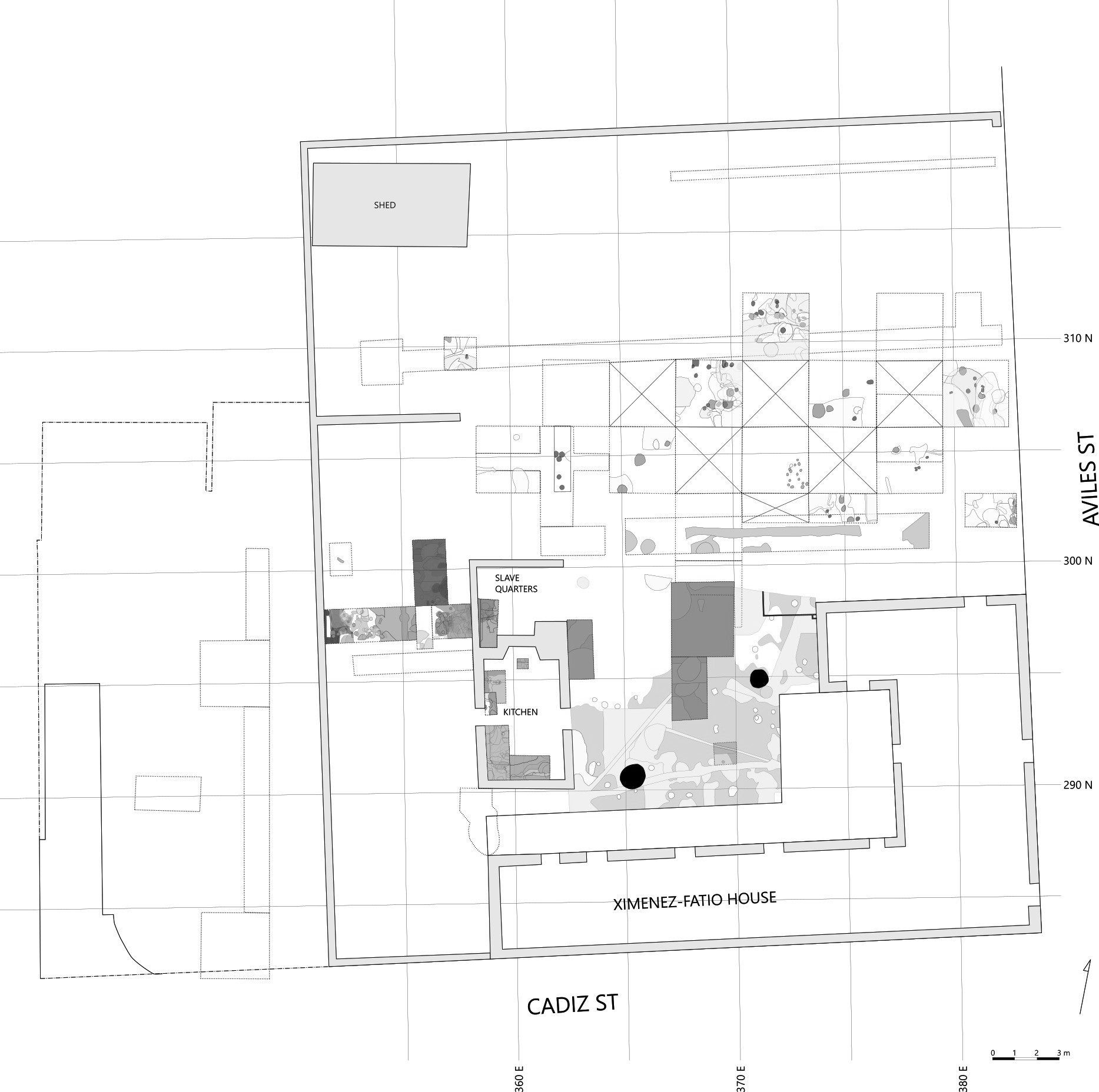
| Feature | Feature Type | Unit Corner |
| F2 | Pit | 296.5N 355E |
| F3 | Pit | 296.5N 355E |
| F4 | Pit | 296.5N 355E |
| F6 | Pit | 290N 358.34E |
| F8 | Pit | 290N 358.34E |
| F9 | Pit | 290N 358.34E |
| F10 | Pit | 290N 358.34E |
| F11 | Pit | 290N 358.34E |
| F12 | Rubble Scatter | 296.5N 350.67E |
| F13 | Pit | 293.2N 358.3E |
| F14 | Trench | 296.5N 350.67E |
| F15 | Pit | 293.2N 358.3E |
| F16 | Pit | 290.06N 359.34E |
| F17 | Pit | 290.06N 359.34E |
| F25 | Pit | 308.5N 356.5E |
| F26 | Pit, Trash | 308.5N 356.5E |
| F27 | Pit/Wash | 308.5N 356.5E |
| F28 | Pit | 308.5N 356.5E |
| FL2-TE (Trench E) | Floor, ormigón | 290N 358.34E |
| FL3-TE (Trench E) | Floor, coquina | 290N 358.34E |
| FL4-TE (Trench E) | Floor, tabby | 290N 358.34E |
| FL4-TF (Trench F) | Floor, tabby | 293.2N 358.3E |
| FL2-TG (Trench G) | Floor, hormigón | 296.1N 357.64E |
| FL2-TH (Trench H) | Floor, hormigón | 290.06N 359.34E |
| FL3-TH (Trench H) | Floor, coquina | 290.06N 359.34E |
| FL4-TH (Trench H) | Floor, tabby | 290.06N 359.34E |
| PITA | Pit | 296.5N 350.67E |
| PIT1A | Pit | 308.5N 356.5E |
| PIT2A | Pit | 308.5N 356.5E |
| PIT5A | Pit | 308.5N 356.5E |
| PIT1B | Pit | 303N 364E |
| PIT2B | Pit | 303N 364E |
| PIT4 | Pit | 303N 364E |
| PIT5B | Pit | 303N 364E |
| PIT3 | Pit | 303N 364E |
| PPH1 | Possible posthole | 293.2N 358.3E |
| PM1A | Postmold | 301.5N 361E |
| PM1B | Postmold | 303N 361E |
| PM2-82 (1982 Field Season) | Postmold | 308.5N 356.5E |
| PM2-85 (1985 Field Season) | Postmold | 303N 361E |
| PM4 | Postmold | 303N 361E |
| PM6 | Postmold | 303N 361E |
| PM9 | Postmold | 303N 361E |
| PPM1 | Possible postmold | 296.5N 355E |
| PPM2 | Possible postmold | 296.5N 350.67E |
| PPM4-TD (Trench D) | Possible postmold | 296.5N 355E |
| PPM4-TF (Trench F) | Possible postmold | 293.2N 358.3E |
| PPM6 | Possible postmold | 290N 358.34E |
| PPM10 | Possible postmold | 296.5N 350.67E |
| PPM11 | Possible postmold | 296.5N 355E |
| PPM14 | Possible postmold | 296.5N 352E |
| SHP1 | Shell pile, oyster | 290N 358.34E |
| SHP2 | Shell pile, oyster | 290N 358.34E |


In contrast to most archaeology websites, iDigStAug contains all of the primary documents associated with the field investigations. By “primary documents” we mean literally all of the field records, field maps, catalogue forms, analytical forms, and photographic slides. In addition, we include technical reports, M.A. theses, and Ph.D. dissertations summarizing some of the studies conducted on these sites. Although iDigStAug contains a digital inventory of re-analyzed artifacts and related contextual records, the availability of the primary documents allows individuals to reach down into minute detail to examine data or drawings that may be of interest. The files are saved in a PDF/A format, an archival protocol that ensures long-term accessibility.

